Management of points of interest (POI) on Garmin GPS (Bernard LEPIN and Marcel GOLL)
The difference between a waypoint and a Point of Interest (POI).
A waypoint is an addressable point (it has a name and it has location coordinates, and is represented by a symbol, a photo…), it is part of a trace or road route, it is an intermediate point or destination. Way point, point on your way, point on your path.
Waypoint is often used as a synonym for points of interest (as in CCWAY).
The point of interest (POI) is information that you add to your GPS mapping, it can be the location of a radar, a restaurant, a gas station… or a col. This point turns into a waypoint when you turn it into a destination or a stage.
On Garmin GPS, depending on the model, the maximum waypoint number can vary between 100 and 5000 points. With the POIs there seems to be no limit (I exceeded 30,000 points without any difficulty).
If you use the waypoints, at some point you will saturate the memory of your GPS – normally this happens the day before you go on holiday (Murphy’s Law).
In practice:
The use of POI gives you peace of mind. POI support varies from model to model, but is similar on all touring GPS systems (Oregon, Dakota, GPSMap …)
With the EDGE GPS family, we go from no support on the Edge 6XX and 7XX, to no official support but correct operation (without the search function) on the 800, on the 810 I have no experience but it must work, and on the Touring and 1000 official support via its menu.
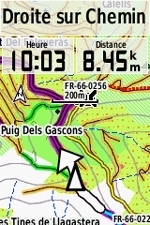
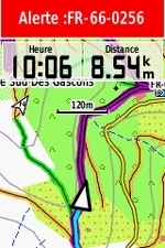
On an 800 on the screen it shows:
- On approche,
- on est à proximité,
- on y est.
- Start by installing POI loader – Garmin’s small free utility from: http://www8.garminfrance.com/support/logiciel/logiciel.php?produit=poiloader
- Create a POI Cols folder that will receive your GPX files organized by country and accessibility. This will prevent you from handling large plugs.The GPX file is a points file, containing the name, the coordinates, the commentary (the comment may be an ISO code)MapSource, BaseCamp will be very useful.
For a given country you will have a set of files:
- Specs FR Routier.gpx
- Specs FR Piste.gpx
- Specs FR Chemin.gpx
- Specs FR Single.gpx
- Specs FR Pedestre.gpx
Etc….
The word specs is not mandatory, but its presence can trigger an alert, which will show a distance you can choose for your col files. For example, I use 400m or 1000m depending on the category of cols.
The alert distance can be defined in two ways:
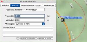
You use the nearby field in your waypoint list.
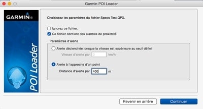
You specify it in POILOADER
The example below is for a single point, but you can do the operation for a whole selection.
The red circle indicates the trigger limit of the alert.
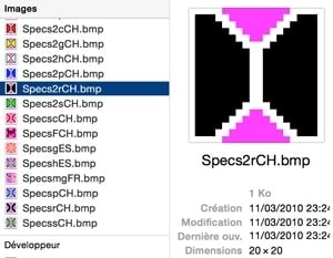
It may be interesting to associate a different symbol with each category.
The symbol will be of a maximum size of 24×24 points with a colour depth of 8.
The colour RGB 255,0,255 (magenta is transparent on the GPS)
Loading POIs
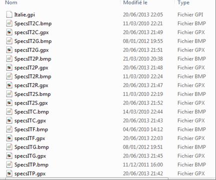
SpecxXXfiles.gpx are placed in a folder for example: POI passes/Italy/
If you use symbols the symbol file type will be .bmp – the name will be identical to the file name
Example:
- SpecsIT2R.gpx
- SpecsIT2R.bmp
For road passes in Italy at 2000m
Etc.
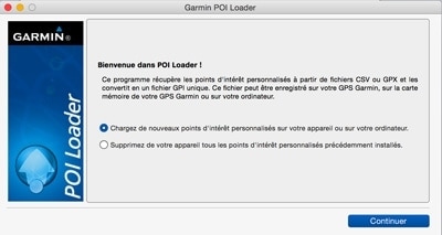
Then you work with your POI loader. Do not hesitate to use the help section of the software which unfortunately is more oriented towards radars than to cols. These screen copies come from a MAC -the screens may differ on a PC.
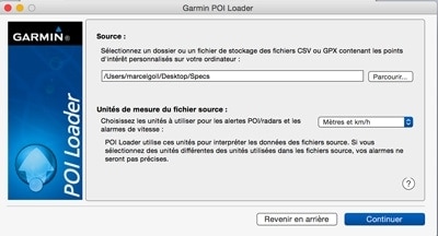
You will indicate the source folder that contains your files .gpx and .bmp.
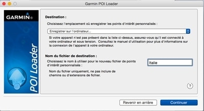
You will then choose where to install thePOIs: computer or GPS –
I suggest starting with the computer.
You choose the name of the POIs file. (Here is Italy)
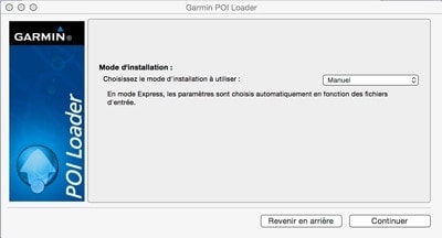
Choose installation in “Manual” mode. In Manual you will have the option to change or delete the alert distance.
Then choose the alert distance for each file. (400m in the example shown).
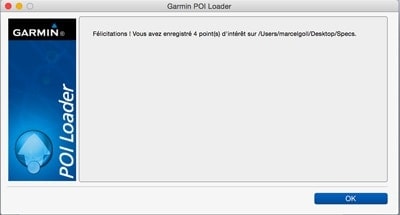
After reading your files you are entitled to Garmin’s congratulations:
You still have to retrieve your POIs file – in this case Europe.gpi and copy it into the folder
Your GPS:/Garmin/Poi/
You still have to check your work:
Start your GPS and depending on the model you look for your POIs (POI loader creates a database by folder, in the example it will be a data base Italy)
On a recent EDGE it will be:
Where to go? Research tool – Supplements – personal POI (garmin forgets qq translations)
Your cols are displayed according to their distance, the closest first.
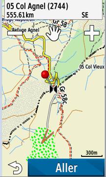
After selecting your destination, this shows:
If you press “Go” your POI becomes a waypoint.
On the right you see 05 Old Col… it is a transparent map, a method that allows you to view all the cols but without any possibility of searching
On the GPS… this may be another topic.

