Agnel pass
COL AGNEL / VALICO DELL'AGNELO: 2744M (south-east facing slope)
IGN coordinates: 54 3637-O 113-048. Michelin number: 77-19-078-139
Thierry PERRET, Cent Cols n°2664 - 71700 TOURNUS.
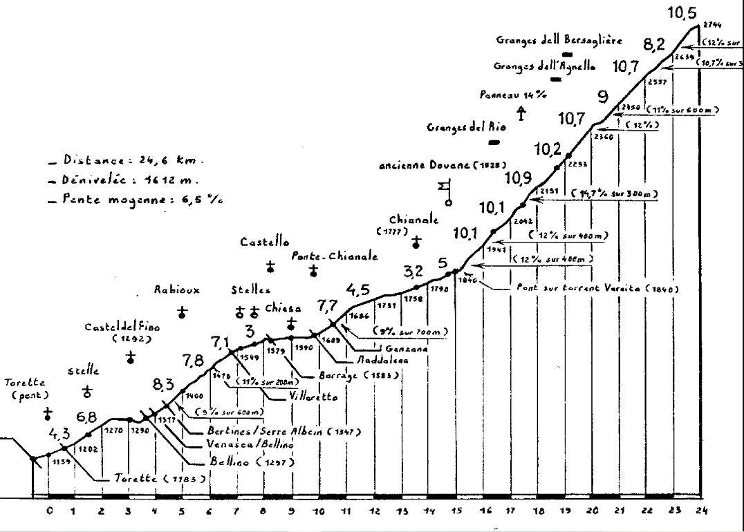
The Col Agnel is the link between the Queyras Regional Park in the Hautes-Alpes and the Val Varaita in the Italian Piedmont. It is precisely on this side of Piedmont that one of the toughest climbs in the Alps takes place, in the category of major passes over 2000m. This little-known giant, which culminates at an altitude of 2744 m, is only a few metres higher than the Col de l'Iseran (2764 m), the Col du Stelvio (2757 m) and the summit of the Bonette (2802 m).
But, more than its altitude, it is its high gradients that impress, particularly in the last nine kilometres after the bridge over the Varaita torrent, where the cyclist will be confronted with a formidable wall at 10% average gradient, but where the gradient often oscillates between 11 and 12%. The bravest part comes at kilometre 17.5 after a right-hand hairpin bend, where a 300-metre climb at over 14% takes you over the spine of the Costa Ciais, the foothills of the Pic d'Asti, clearly visible to the north-east, while the road climbs the Agnel valley in long, straight sections. The route then takes in a series of eight hairpin bends, punctuated by a short flat area (3% for 300 m) after the twentieth kilometre. This will be the only place to take a breather before tackling 3.3 very difficult kilometres ranging from 11 to 12%! The last three hundred metres before the pass will be negotiated at just 6.6%. Note that this nine-kilometre wall lies at an altitude of between 1,840 m and 2,744 m, which further increases the effort required to make progress...
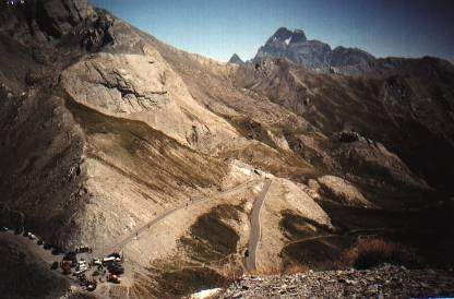
The Col Agnel starts at Torette, at an altitude of 1143m, as it is from this hamlet that the real climb begins. As far as Chianale, the variable gradient, with a few steep sections ranging from 9 to 11%, provides a good warm-up before tackling the final section. The scenery on this first section is relaxing and very pleasant as you ride along the shore of Lake Castello. After the old customs post, the scenery becomes increasingly mineral as you approach the pass, dominated to the north-east by the Pain de Sucre (3208 m) and the Pic d'Asti (3220 m), while in the background to the east, Mont Viso seems to reign supreme from the top of its 3841 m!
This grandiose landscape is a fine reward, crowning an effort of 1 hour 38 minutes (the time taken by the author at the start from Torette).
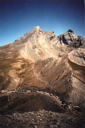
Photo taken from south to north. View of the Col Agnel with the Pain de Sucre (3208m) and the Pic d'Asti (3220m) in the background. You can also see the path that leads from the Col Agnel up to the «Col Vieux d'Agnel», a beautiful mule track at 2770m.
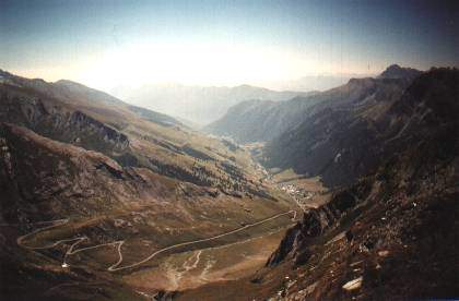
View of the Italian side (shown in profile)
The village of Chianale and Lake Castello can be seen in the Val Varaita.
Italian side, background: Mont Viso 3841m.
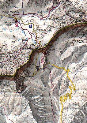
Extract from TOP25 map 3637OT Col Agnel