Col de la Bonette
Question: I dream of climbing the Col de la Bonette. What passes are accessible in the area of this legendary pass?
Response:
There are six passes, all over 2000m, which can be crossed in a day. If the above question comes up often, it's because a certain amount of confusion is fostered either by maps that aren't very accurate (because of their scale), or by signs that are enticing but bear no relation to reality. The sign posted just outside Jausiers, at the foot of the ascent to the Col de la Bonette, is a model of its kind.

There are three errors:
- The Col de la Bonette should not be confused with the Col de Restefond, as they are two different passes.
- The Col de la Bonette does not rise to 2802m but to 2715m.
- It's not the highest road in Europe, because it's in the Sierra Nevada in Spain (editor's note: in 2026 the road will be closed to cars).
What does the IGN TOP25 map n° 3639OT say?

Leaving the Ubaye valley (Jausiers), the départementale 64 passes close to the «Faux col de Restefond» (FR-04-2639). Nearby, because the pass is just below the tarmac road, on an R1 track that leads to the Col de la Moutière.
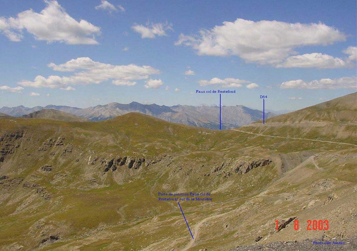
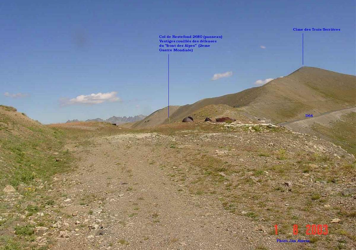
300m beyond the junction of the track leading to the Col de la Moutière, a R1-2 track opens up on the left, this time leading to the Col de Restefond (FR-04-2692b) at an altitude of 2680m. This pass is slightly above the D64. The name of the pass is indicated by a sign at the top. Remnants of Second World War fighting can still be seen in the vicinity.
The trail continues along the northern slopes of the Cime des Trois Serrières to the Col de Raspaillon. This is the old military road that existed before the opening of the Bonette «loop».
PLEASE NOTE: the Col de Restefond is only accessible by entering the Mercantour National Park (for 250m!). Access is strictly forbidden to bicycles...
Back on the D64. The Col de la Bonette (FR-04-2715) opens up like a gap on the left. It takes you directly into the Tinée valley.
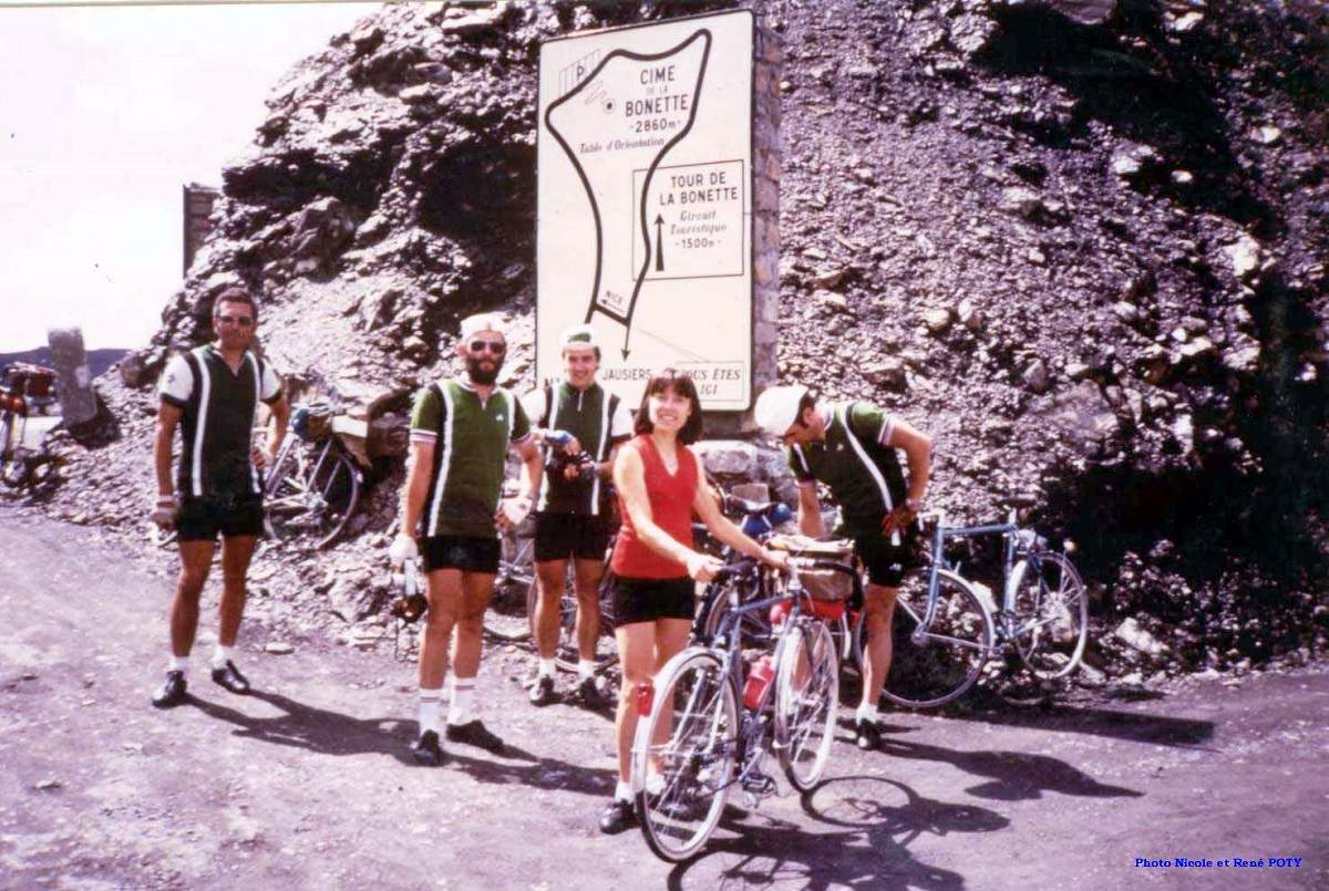
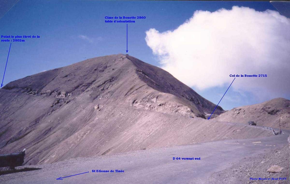
If you don't cross the Col de la Bonette, the road continues steeply uphill around the summit of the Bonette, passing the highest point: 2802m, which is often mistaken for the Col itself. A monument marks the top of the road and a short walk takes you to the orientation table at 2860m, where the view is breathtaking.
The D64 then approaches the southern slope.
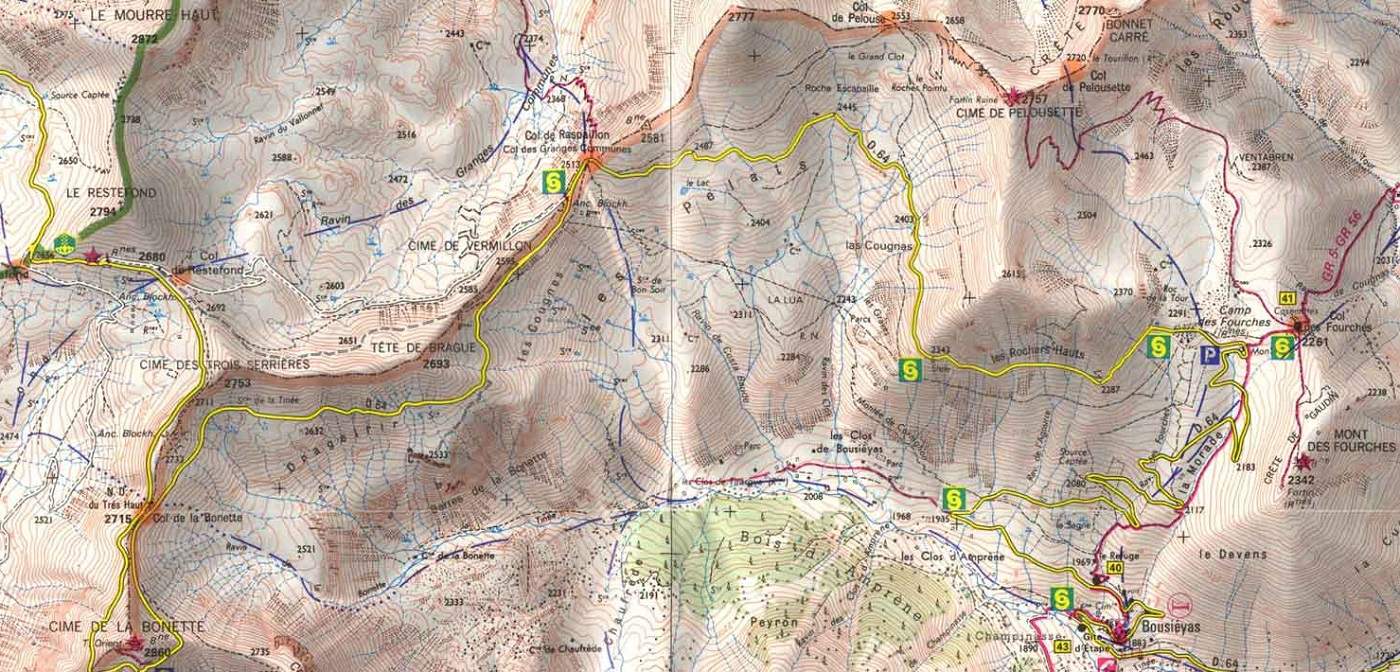
The Col de la Bonette opens up on the left this time, then, on the descent, you cross the Col de Raspaillon or des Granges Communes (FR-04-2513). Finally, four kilometres further on, just after the ruins of the Fourches camp, an R1 track leads off to the left to easily reach the Col des Fourches (FR-06-2261b), 200m from the tarmac.
WARNING: the Col des Fourches is in the Mercantour National Park!
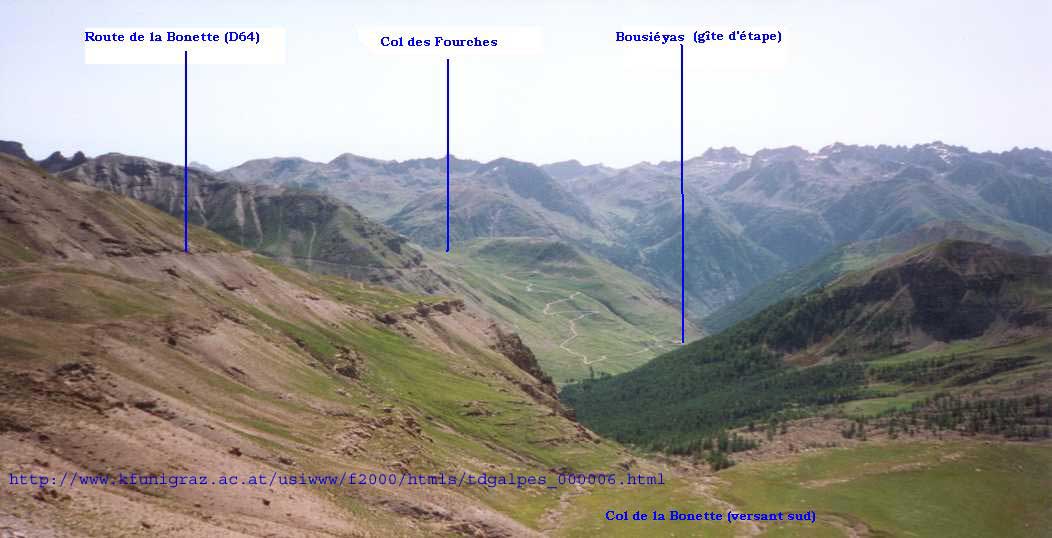
For a looping walk back to the Ubaye valley, you can return via the Col de la Moutière, where the road from Saint-Dalmas-le-Selvage is now tarmacked. The north side is not, and you have the choice of either joining the D64 at the Faux col de Restefond via R1 tracks, or descending to Bayasse (on the ascent to the col de la Cayolle) and returning to Barcelonnette via the D902.
We wish you a safe journey.
René Poty