Parpaillon pass
The PARPAILLON pass (FR-04-2637) 54 3538-O 133-031
If ever there was a legendary pass, it's the Parpaillon! Located on the border between the Alpes de Haute-Provence and the Hautes-Alpes, it culminates at 2637m on a ridge separating the Durance and Ubaye valleys. The pass was opened by military engineers, as were many other crossings along the Grande Traversée des Alpes between Thonon and Nice.
The «luck» of the Parpaillon is that it was in competition with the Vars pass, which provided a link between the same valleys but at an altitude 500m lower. When tarmac was introduced, it was the Vars pass that was naturally given it! The Col du Parpaillon is therefore one of the last remaining examples of what a major Alpine pass could have been before the era of the car and tarmac.
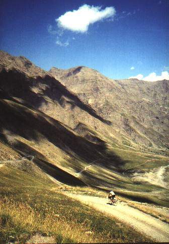
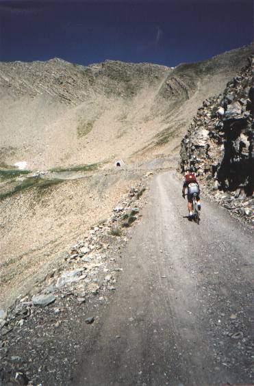
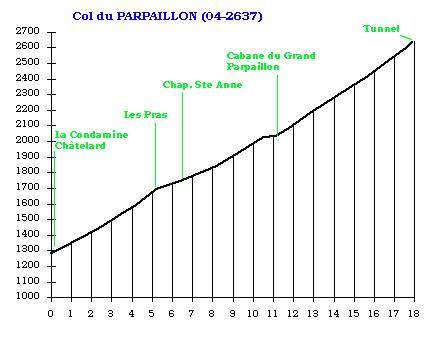
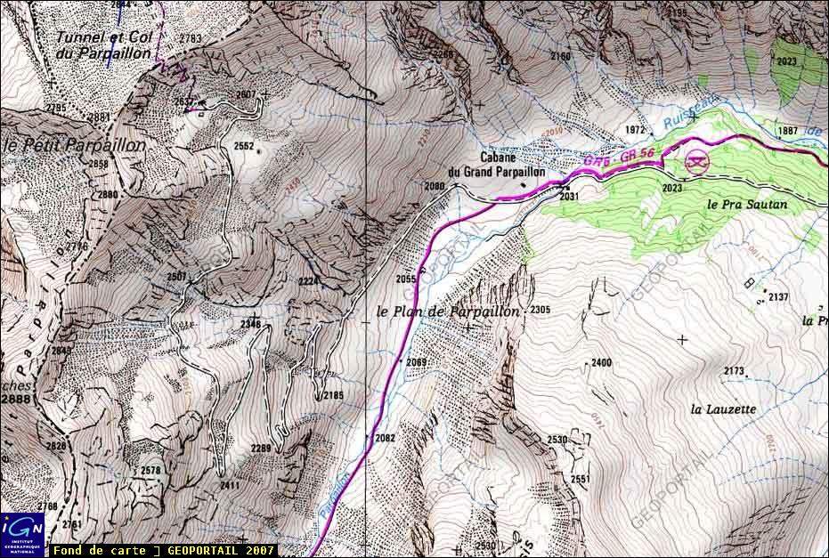
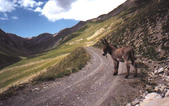
Even today, the Parpaillon is a magnet for anyone looking for an unspoilt, pure, wild mountain to slip into as a guest. From Condamine-Châtelard, the south-facing slope offers a difference in altitude of around 1,400m over 18km. Only the first 6km are tarmac, the rest is a good R1 track that first rises under the larches, then leads into a wide valley where the «Cabane du Grand Parpaillon» nestles at 2031m. This is a high mountain environment, with alpine pastures, rocky outcrops, large scree cones and no human occupation whatsoever. The trail climbs up majestic switchbacks to the famous summit tunnel... A tunnel with wooden doors (sometimes blocked by snow if you've got there too early in the season!). It's a dark, icy tunnel that you pass through with your eyes fixed on the tiny light hole at the exit, allowing you to wade through a few dark puddles while pushing your bike...
Purists will be able to climb the «real» pass (FR-04-2783) by taking the S3-4 path that crosses the ridge above the tunnel at around 2780m. The views are magnificent.
On the northern slopes, there's not a soul to be seen before the small village of La Chalp, where the tarmac reappears.
The Col du Parpaillon can be climbed on a superb circuit which, from Condamine, takes in the Col du Parpaillon, the Col de la Coche (FR-05-1791), Col de Valbelle (FR-05-2372), Col de Chérine (FR-05-2270) and Col de Vars (FR-04-2108). The most determined can even add the Col de Girabeau (FR-05-2488b), the Col du Vallon (FR-05-2466b) and the Saluces Pass (FR-05-2444) but you'll need to plan a long day's cycling for that!
Article by René Poty
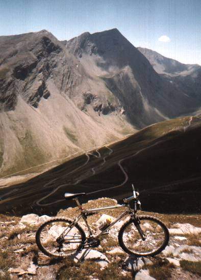
In the distance: the notch in the Col de la Pare (2655m) Photo by Caty.