Mount Chaberton
Text and photo credits Philippe Girardin
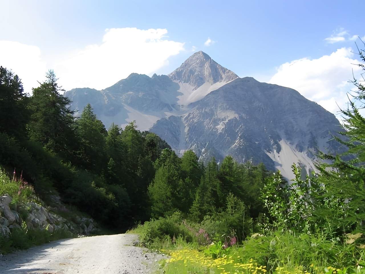
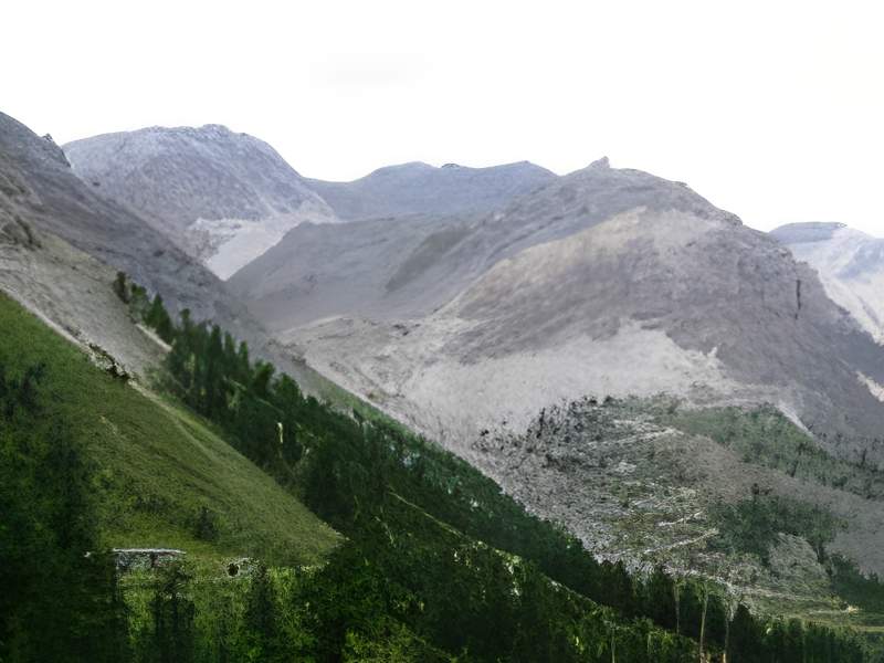
Mount Chaberton, which rises to 3131m, is a must for mountain bikers.
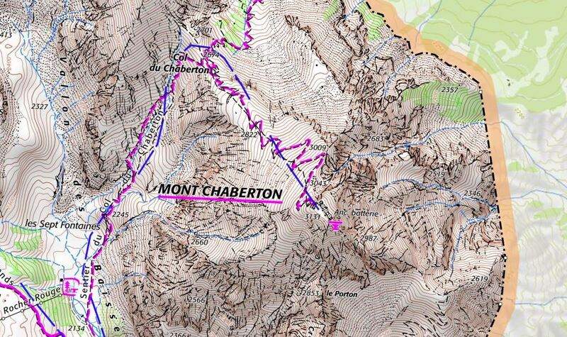
Mount Chaberton and the Chaberton pass (FR-05-2674) are reasonably accessible by mountain bike, despite the 1,900m vertical drop that prevents access from the Italian side. The track has been carefully resurfaced up to kilometre 10. The eleventh and final kilometre to the pass may soon be resurfaced. From the pass, there are three kilometres to the summit of Mont Chaberton, all of which can be covered on foot for the ascent. The descent can be done by bike, but is recommended only for experienced descenders. There are whispers in Montgenèvre that a ski lift could provide access in the future. So get out there before the charm of isolation and the sense of adventure that this route still exudes disappear for good. It's a shame to aim only for the pass at 2674m. Be open-minded and unselfish enough to climb to the summit at 3131 m - you won't regret it!
A little history
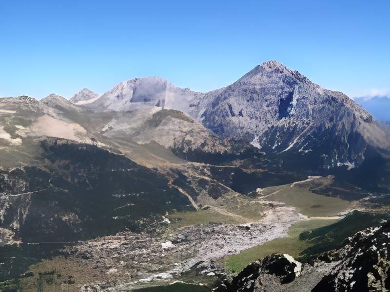
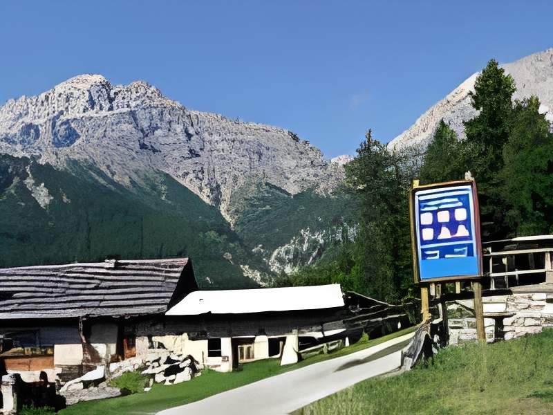
Mont Chaberton is a remarkable summit. Close to the Italian border, it proudly dominates the towns of Montgenèvre on the French side and Cesana-Torinese on the Italian side, and can be seen from afar. Its south face seems inaccessible, as if in one fell swoop for 1500 metres. Before the Second World War, Mont Chaberton was Italian and its north face was relatively accessible on a gentle slope. This strategic situation gave the Italian army the idea of equipping the summit with a fort armed with powerful cannons.

Wikipedia
Before the Second World War, Italian troops built a battery of eight turrets, topped with cannons, facing towards France and the town of Briançon. They defended the Montgenèvre pass (FR-05-1850). To achieve this, soldiers and engineers built a road from the village of Fenils (Susa Valley). They abraded the summit of Mount Chaberton to create a defensive glacis for the turrets. The fort, sometimes nicknamed the «Fort of Clouds», was the pride of the Italian military. At the time, it was reputed to be the highest and one of the most powerful forts in the world. A few days after Italy's entry into the war in June 1940, guided by the fort du Janus, the Italian battery was destroyed by fire from the 154e Position Artillery Regiment of the French Army. At the end of the war, the Baisses valley, the summit of Mont Chaberton and the battery were annexed by France. As a result, the Franco-Italian border was moved to the entrance to the Italian village of Clavière.
The fort was built from 1891 onwards thanks to a major labour effort. The current track was probably opened during this period. It was used to hoist men and equipment for the construction of a cable car. A total of 8 149 mm cannons, all perched on eight masonry turrets, overlooked a barracks 113 m high 18....
At the start of the Second World War, this enemy Italian fort was a major concern for the French command. It installed 280mm mortars hidden against the slope of the Italian observers under the Col des Gondrans (FR-05-2347a), and observatories (at Janus). When hostilities broke out, the French artillery succeeded in destroying the batteries on Mont Chaberton and its ammunition depot on 21 June 1940. This feat was made possible by perfectly developed ballistic science (parabolic fire from a distance of 10 km on a target just a few dozen metres away!) The assault lasted three and a half hours, with fifty-seven shots on target, instantly ruining years of effort. The batteries on Mont Chaberton were silenced forever. We can imagine that this feat of arms motivated the annexation of the mountain by France in 1945.
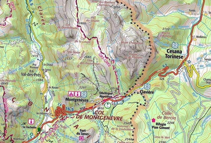
We understood from this story that the access road was on the Italian side. On the French side, there is only an «S3-S4» path that leads up from 2177 after a good track that climbs up from Montgenèvre.
The climb to the pass at 2674 m and the mountain at 3131 m
You leave the state road a few kilometres north of Cesana-Torinese to take the small surfaced road to Fenils. If you are coming from France, you will have to make the 8 km descent of the Montgenèvre pass, which is not only not very pleasant and dangerous because of the traffic, but also because of the many long tunnels.
The climb begins at a bridge just before Fenils, at an altitude of 1230m. From the outset, the slope is steep. There's no respite on the 11 km that lead to the pass (the average percentage of these 11 km is 13%, so don't expect to find any places with less than 8 or 9%). So you have to be determined.
On leaving Fenils, you reach an altitude of 1276 m. This is where the tarmac road gives way to a dirt track that is suitable for cycling. On this path you will find some stonier sections that will threaten the grip of the rear wheel. It is therefore advisable and safe to cross these tricky sections on foot.
After 2.5 km, you come to the hamlet of Pra Claud, perched at 1589m. At the entrance to this hamlet there is a large sign indicating that the trail is closed to all vehicles.
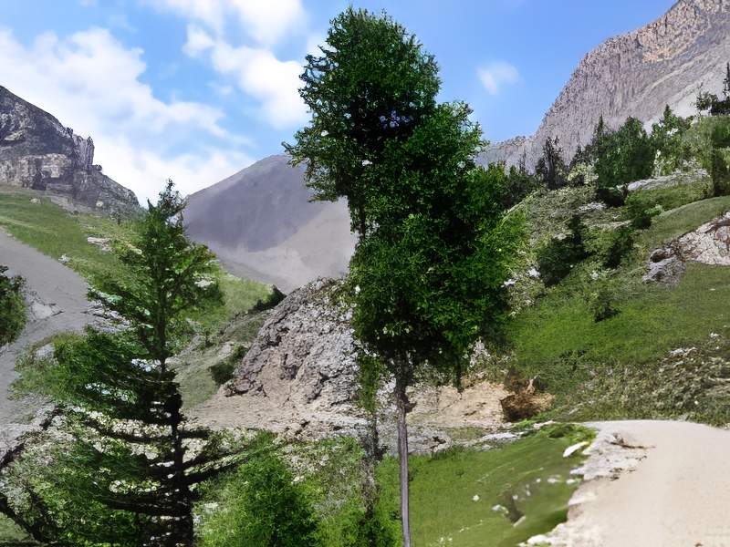
We then come to the first big pile of switchbacks still in the vegetation. There are regularly wooden benches by the side of the track where you can rest! This takes us towards 2000 m and the crossing of a torrent. The slope continues unabated and soon takes us to 2099m, where there is another series of switchbacks. On the left is the start of another track that runs along the side of the mountain and joins the Cresta Nera and the Colletto di Cresta Nera (IT-TO-2201).
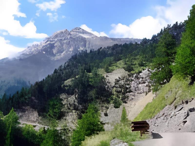
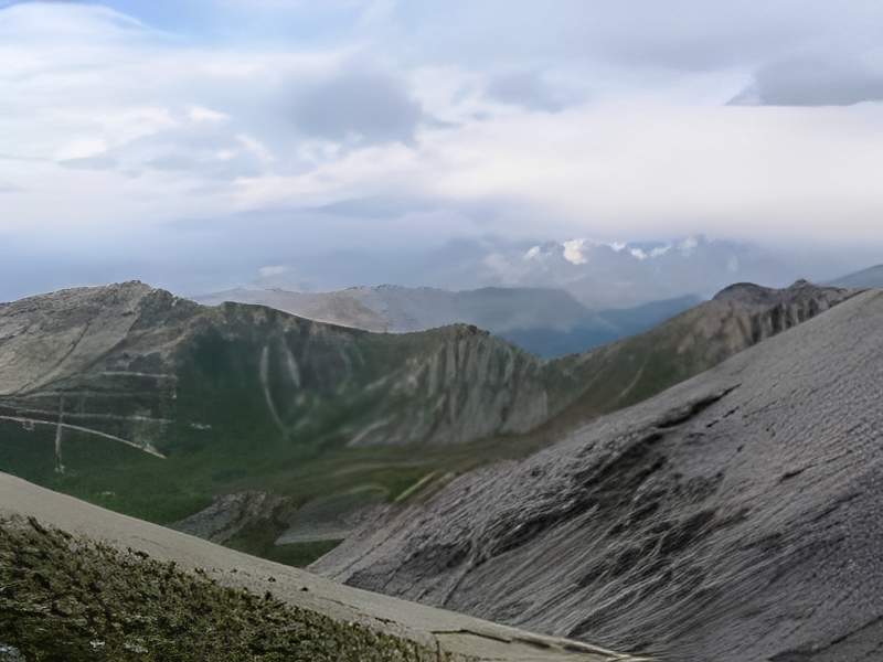
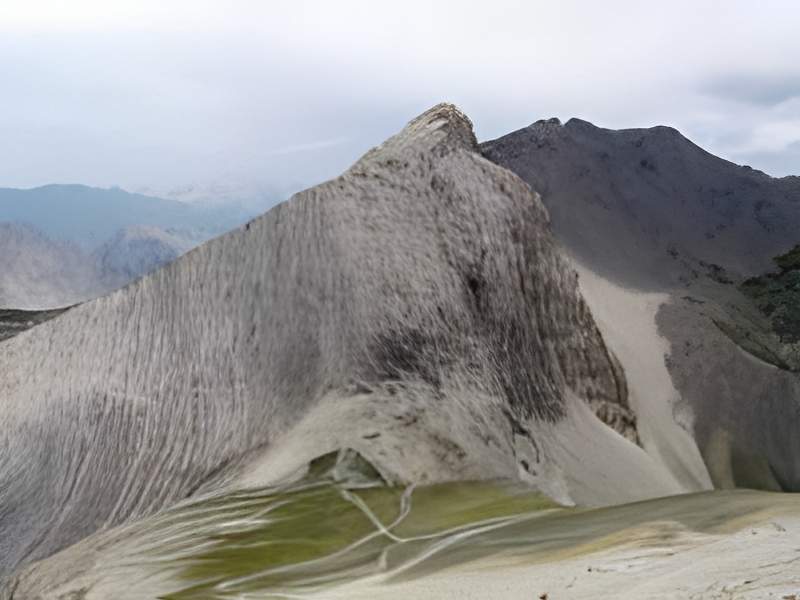
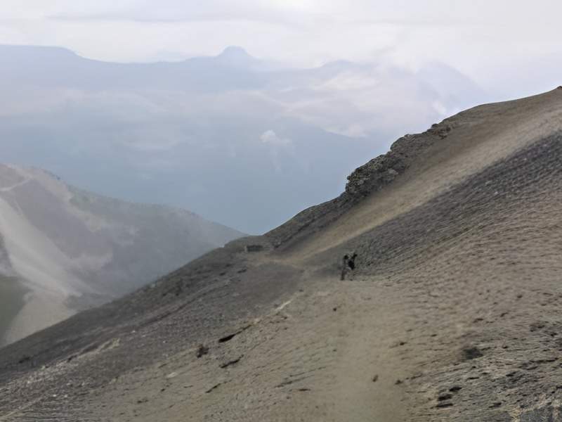
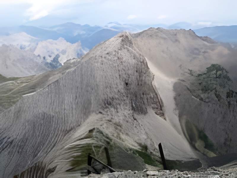
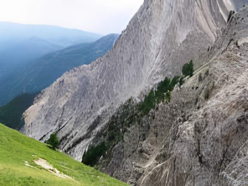
From here on, the world becomes completely mineral. The slope and the pebbles on the track make progress difficult. We gradually climb upwards, making a sustained effort until we reach the entrance to the col's valley. Entering the valley offers an impressive view of the scree and rocky masses. We can also see that efforts are being made to rehabilitate the trail, with the addition of a few walls and retaining platforms. The slope eases somewhat but the presence of rocks on the track increases and makes progress tricky.
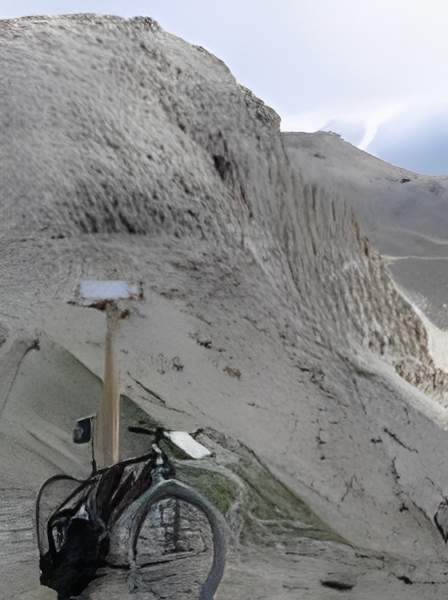
The last kilometre under the pass, and it's hard to find the actual route of the track because it's so broken up at this point. Walking becomes compulsory. For the last few metres, the track has disappeared and been replaced by a path. At the top of the pass, a strong wind greets you. A sign points the way to the summit. There's already a fine view of the Oisans, with the dizzying descent of the French side of the path in the foreground.
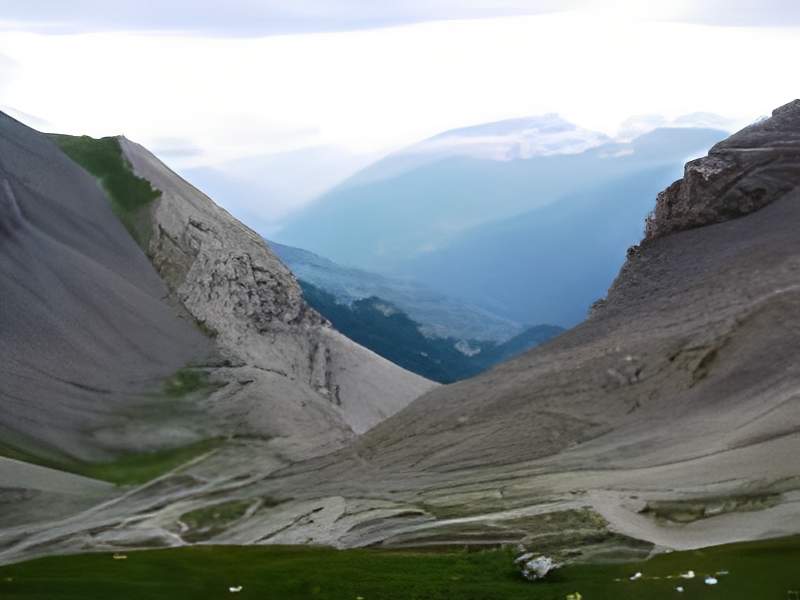
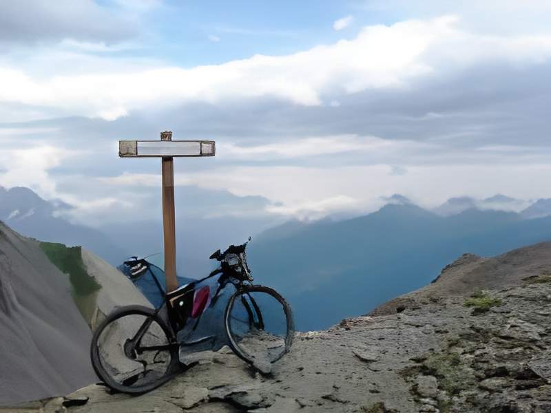
Take heart, there's only 450 metres of ascent over 3 kilometres, which means an average of 15% to finish. It looks like a huge bare slope that can be climbed (very) partially on a mountain bike, following the well-marked zigzags of the path. The landscape is entirely mineral. On the ground we find remnants of the fort areas, namely metal posts and barbed wire. A huge metal cable running for hundreds of metres on the ground may be evidence of the cable car? Breathtaking: the view, of course, but don't forget the wind too. It will be impossible to get off the bike for fear of being blown against the wall or down the slope.
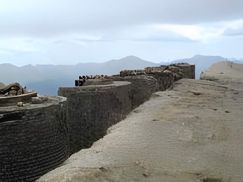
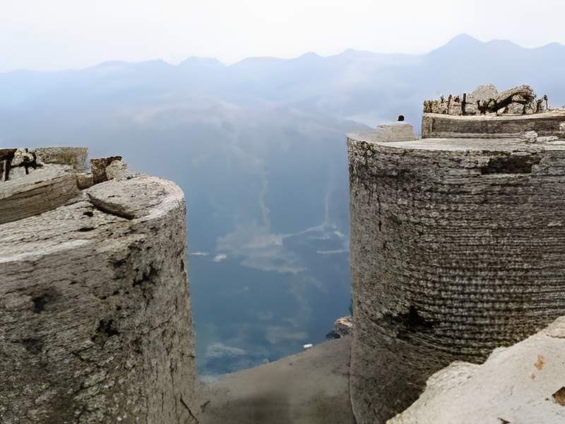
In forty minutes, you arrive almost surprised on the final glacis and wonder if the climb is already over. The platform, surprisingly flat, horizontal and without a single blade of grass, is only a few dozen metres square. Around it, more than 1,500 metres of emptiness is impressive. Well hidden by the glacis on the French side, the eight masonry turrets that served as gun mountings can be seen.
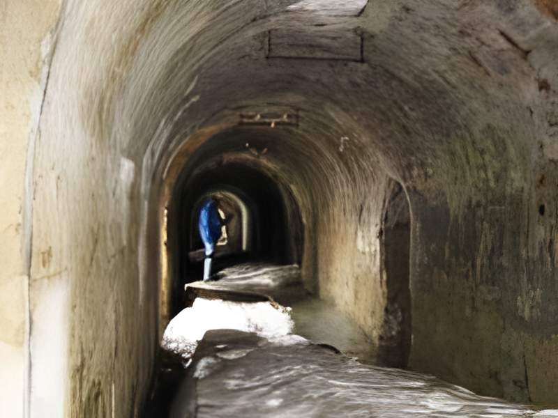
They appear almost intact. The fort itself shows vaulted galleries in good condition, and remnants of the last snows. A group of Italians picnic in the shelter. The living and sleeping quarters are much lower down, on a well-concealed platform to the north-east.
As the weather is threatening, there's no time to linger, and a storm on these bare slopes must be a rather unpleasant ordeal.
The descent
Caution and walking are the order of the day for the first few kilometres of the descent, although a good mountain biker in good weather would have no difficulty. The light rain, which is now falling horizontally, is colouring the pebbles in lovely shades of light and dark. The constant gusts of wind discouraged us from getting on the bike.
Relief as we reach the pass and dive into the sheltered Italian side. We pass a number of mountain bikers who are taking their turn to climb the pass. I counted a total of 18 on this August day. As I look at them, I realise that not all of them are equipped to reach the summit. There were Germans, Swiss and Italians, but no French that day. But what a success this Mont Chaberton was all the same!
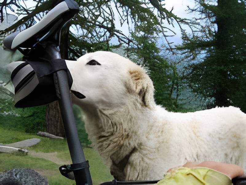
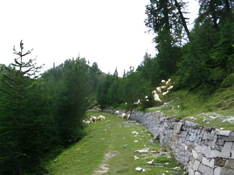
We have no trouble finding the 2099 mark. At this point we take the forest track that heads south over woods and meadows. The aim is to find the Colletto di Cresta Nera (IT-TO-2201) following an easy S3 for 1.5 km. But something typical of this area of the Italian Piedmont happened, as we were alerted and quickly intrigued by barking which became louder and louder as dogs approached us. We saw two large patous appear in front of us from their guarding area below. All along the route we were alerted by signs indicating the presence of these guard dogs. Faced with these herdsmen we must not make any mistakes, we must not provoke them or show any bravery. I choose to make myself very small by protecting myself behind my bike. The patous come up and sniff me out. To give you an idea of their size, I can see that their heads are level with the seatpost. After sniffing me for a few seconds, the dogs decided to abandon me, probably judging that I was no real threat to their herd. Luckily they didn't know about my taste for leg of lamb. Before walking away, one of the dogs took care to piss on my rear wheel. Phew! they've gone and I can get back on the road. They're nice and beautiful little creatures, but they're «not delicate», as the locals say. You have to be careful above all else, so you've been warned.
The return from the Colletto di Cresta Nera was uneventful, despite a few barks in the distance. The brakes were hard at work on this descent. Back on the road to Cesana, I found a bit of climbing to finish. A great experience for anyone who loves the mountains and their grandiose solitude.
It was 7 August 2008 for my pass numbers 2972 and 2973 and for me it represented my Olympic Games.